Walk 3 – Heage, Hartsay and the Cromford Canal (4.25 miles)
The Cromford Canal is a lovely and well-known walking route. But this walk takes in part of the route of the canal which is much less known. It also has some splendid views. The walk is based on Walk 5 of the Amber Valley Routeways series. Roadside parking is in Upper Hartsay near to Hartsay Hall Farm near to a post box and disused phone box.
From Hartsay Hall Farm walk up the road a little way uphill (towards Ripley). Ignore the first track and footpath sign on the opposite side of the road. Just before the road bends cross the road carefully and take the track between farm buildings at the footpath sign. Follow this track round a left hand bend and down the hill enjoying the first views of the walk towards Crich stand.
At a gate look for a stile and footpath markers on the left and follow the path that gently descends following the side of the field. At a gate cross the next field and head towards a stile and a path that takes a sharp left turn to pass a house on the right. Head through the gap in the hedge and then turn left for a few metres to cross a stile and turn left again to walk alongside a section of the Cromford Canal.
The canal was originally 14.5 miles long and built by William Jessop and Benjamin Outram opening in 1794. It ran from Cromford to Langley Mill where it joined the Erewash Canal carrying limestone, coal and cotton. It was abandoned in 1944.
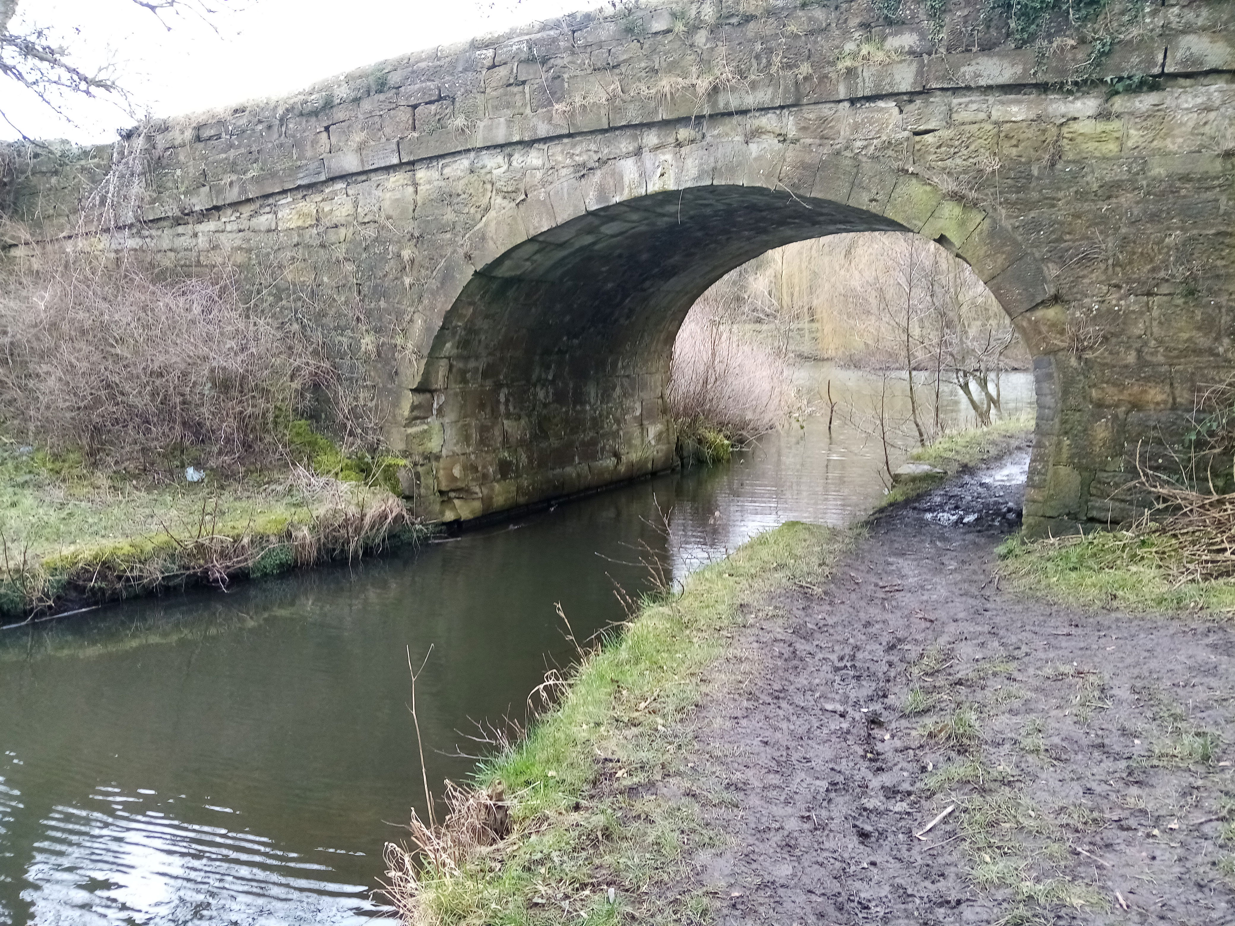
As the path approaches a lane with a playground on the left turn right to cross the now silted up canal and then left along the old towpath to a road. Immediately across the road you will see a path past some terraced houses which continues on across fields and a number of stiles still following the route of the Canal but with little evidence of water! As you enter a large field head across to buildings in the distance (Pear Tree Farm) crossing a small footbridge, approaching and then keeping the hedge to your right. Shortly you will come to some fishing lakes and Starvehimvalley Bridge.
The bridge is Grade II listed and part of the original canal although no-one seems to know where the unusual name comes from.
Continue following the path which brings you into the car park behind the Excavator pub and under a disused railway bridge. Go behind the pub and across the car park heading for a small tunnel where the line of the canal towpath is clearly visible. Once through the tunnel, you have a choice here – you can follow the footpath waymarkers which runs alongside the main road. Alternatively head slightly left through some trees and then turn right to walk along an old railway line through some interesting cuttings.
This is the former Buckland Hollow branch line. The branch, off the Midland Railway’s Ambergate to Pye Bridge line, served Ambergate Brickworks and Heage and Hartshay Collieries. Passenger services on the Ambergate to Pye Bridge line ceased in 1947 and the line closed completely in December 1968.
Both the footpath and the railway track end at the entrance road to the Lockwood Group site. From the railway line turn left to walk up the access road. From the footpath cross the entrance road and then follow a path over a four arched bridge. At the far end of the bridge and just before the site entrance you will see a track past some farm buildings (look for the walk markers). Head up the hill and cross a stile into a field. Continue with the field edge on the right. As you descend to a gate take the left-hand stile and head diagonally up to the top corner of the field, looking back across the valley for some fine views.
Cross the stile and turn right alongside the hedge heading for a squeeze stile pausing to explore the secret cave in the tree roots on the right hand side. Past the squeeze stile head across the field, past the green dome of a water reservoir vent and on to another stone stile. Turn sharp right and then head slightly uphill through some hawthorn to a hidden stile and then uphill to a gate onto a lane. The lane is the access road for Heage windmill.
Heage, a derivation of ‘High Edge’ comes from Anglo-Saxon meaning high, lofty and sublime. The windmill was originally built in 1797 and restored in 2002. It is the only working six-sailed stone tower windmill in England. It is usually open to the public every Saturday and Sunday from Easter to the end of October.
Cross the lane and head across the field to a gate onto a path between gardens. When the path reaches the road turn left past Heage Village Hall. At the T Junction turn left and follow this road over the brow of the hill and then down to the Eagle Tavern. Go past the Tavern and keep following this road through Heage village to return to your car.